CRC Comments on Proposed South Fork Development
The primary goal of the Chiricahua Regional Council is to protect valuable intact habitats in the Chiricahua Ecosystem Management Area and private lands in this region. To accomplish this, we work with the Forest Service, other governmental agencies, and private entities on issues that impact our unique assemblage of habitats, which together comprise North America’s greatest terrestrial biodiversity.
The Chiricahua Regional Council (CRC) is the only citizen-based organization in the Cave Creek Canyon area with the primary goal of conservation. We represent diverse interests ranging from ranchers, scientists, writers, artists and conservationists to year-round and Summer Recreation Residence homeowners and Outfitter-Guide ecotourism permittees.
CRC formed in the early 1990s in response to a proposed open-pit gold mine that would have overwhelmed the Portal community and the lower reaches of Cave Creek Canyon. We gained the support of Newmont Corporation for a complete halt of their plans to mine in this location and for a complete withdrawal from mineral entry of the federal lands involved.
CRC was then successful in achieving permanent federal withdrawal of 13,000 acres around Portal from mineral entry via the Cave Creek Protection Act of 1993, with unanimous support from the Arizona Congressional delegation.
In the early 1990s, CRC substantially aided successful efforts to keep Cave Creek Canyon and the Coronado National Forest free from major developments that were intrinsic to an ill-conceived National Recreation Area proposed for the Coronado NF.
CRC worked closely with the Coronado National Forest to support a designation of the 25,764-acre Birds of Prey Zoological-Botanical Area (ZBA), overlying the existing 786-acre South Fork ZBA and now the largest ZBA on the Coronado National Forest.
We appreciate the opportunity to comment on the recent draft EA regarding development within the South Fork ZBA.
We believe that the need for these developments has not been adequately justified and especially that siting them in South Fork is neither favorable nor necessary. In fact, it poses serious inconsistencies with the very special natural values of this location.
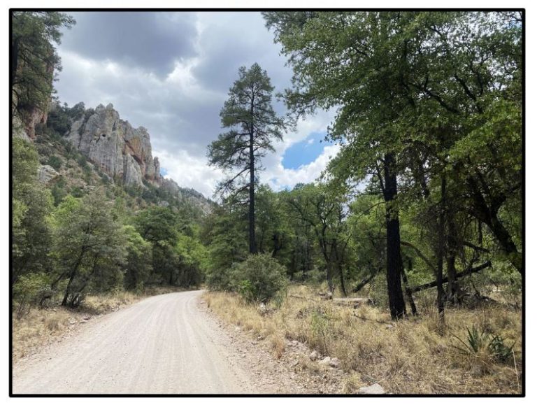
The importance of South Fork has been recognized by the Forest Service through its designation as a Zoological-Botanical Area (ZBA) and more recently by its inclusion as part of a special Birds of Prey ZBA. These designations are appropriate and are fully supported by the public. To preserve these special values, we must reject any proposal that would fragment South Fork’s limited canyon bottom and degrade the natural values that the ZBA was created to protect.
South Fork is fragile and cannot stand overuse without significant degradation. The CRC fully supports rational and flexible use of the area by the public so long as the uses cause no degradation of the area. Again, the CRC’s mission is to preserve intact habitats. The overall goal of the Forest Service for South Fork must be first to favor long-term polices that preserve its natural values and prevent degradation, and secondarily to manage visitation to that end.
All indications are that quiet enjoyment of and protection of existing natural features of this canyon, especially those of South Fork, remain the overwhelming preference of the user public. These values remain the overwhelming consensus of CRC’s membership as well. In proposing a National Recreation Area for the Chiricahuas, Pinaleños, Huachucas and Catalinas in the 1990s, the Forest Service held public meetings around southeastern Arizona to sample public opinion. At these meetings we saw clearly that the public fiercely rejected the sort of developments promised by a National Recreation Area––and the proposal quickly died due to lack of public support. Opposition came from all segments of local society. Similarly, in past public opinion surveys conducted with users of Cave Creek Canyon by researchers from the University of Arizona, the overwhelming sentiment documented has been uniform and profound opposition to new developments in the canyon.
The draft EA is seriously deficient in not adequately considering viable alternatives to its favored Alternative B. The reader is asked to make a choice between this single development alternative and a No Action alternative that fails to consider some beneficial adjustments that could be made to South Fork management. This woefully incomplete approach is not a proper way to design optimal management of the area.
The CRC has no option but to endorse the no action Alternative A because no other viable option is presented. We feel that optimal management of South Fork and the rest of Cave Creek Canyon should consider a variety of other options.
The Coronado National Forest cannot move forward with this project unless the current Coronado National Forest Land and Resource Management Plan (LRMP) is amended to allow for, and to specify, acceptable levels of impact.
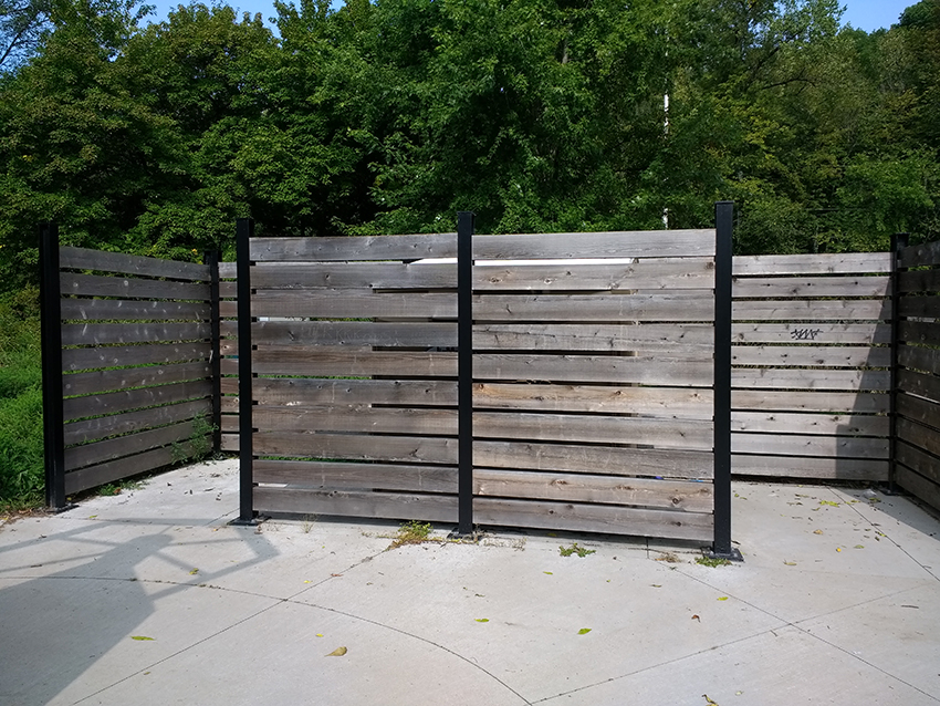
The draft EA proposes new construction actions within South Fork. These are presented as “replacements” for amenities that were destroyed in 2014 by flooding associated with Hurricane Odile. However, these are not replacements, but new construction. Replacement means rebuilding on a previously developed site.
The conditions on the ground as the plan was developed and finalized are the same as they are today. The Forest Plan does not mention replacing any of the infrastructure washed out by Hurricane Odile, even though the Forest Service was well aware of the on-the-ground conditions for a period of four years prior to the release of the Final EIS. There is no Suitability Analysis for South Fork to be found within the current Forest Plan.
In looking at Table 14. Suitability of selected activities by management areas (pg. 168 LRMP), one finds that not only is there is no Suitability Analysis for South Fork, but none for ZBAs in general. This table should present factors determining the suitability of impacts by potential management decisions.
We do find specific Suitability Analyses for the Wet Canyon Talussnail Zoological Area (Pinaleño Mountains), as well as the Wild Chile Botanical Area (Tumacacori Highlands): those analyses determine what activities are suitable and unsuitable in these protected areas.
In personal correspondence with the Coronado National Forest Planner Emily Reynolds, it was confirmed that the guidance for ZBAs on the Coronado NF is found in the current forest plan: “Zoological and botanical areas are managed by the standards, guidelines, objectives, and desired conditions of the 2018 Coronado National Forest Land and Resource Management Plan.”
The only guidance found in the current forest plan regarding ZBAs generally, and the South Fork specifically, would preclude development of any type within the South Fork ZBA.
In fact, the plan clearly states under Desired Conditions (pg. 129 LRMP) “all special areas are characterized by generally unmodified environments in which unique natural features are preserved. Each special area provides an example of one or more unique features within the Coronado National Forest. Scenic conditions are natural, unaltered, and wholly intact. Landscape character and sense of place are evident at the highest possible level” (emphasis added).
Desired Conditions for Botanical areas “protect the plants and plant communities for which they are designated. Plants and plant communities within these areas are resilient and are not negatively impacted by human activities. Nonmotorized recreation is allowed on a limited basis on designated trails to protect soil conditions and hydrologic flow. New trails are discouraged.”
Desired Conditions for Zoological areas “protect the unique wildlife and associated habitat for which they are designated. These areas contain unique or significant animals, animal groups, or animal communities, habitat, location, life history, ecology, environment, rarity, or other features.”
“Research natural areas and botanical and zoological areas are designated to ensure protection of specific biological and zoological communities.” (Pg122 LRMP)
Under Desired Conditions for the Chiricahua Ecosystem Management Area, the Forest Plan states “Cave Creek Canyon supports a full cohort of native nesting birds, particularly cavity-nesting birds, and provides opportunities for world-class birding. Unique wildlife and vegetation species are perpetuated in the South Fork of Cave Creek Zoological-Botanical Area and the Pole Bridge Research Natural Area. The unique resources that provide habitat for the highest number of birds of prey in the U.S. are maintained or enhanced in the Cave Creek Canyon Birds of Prey Zoological-Botanical Area. Recreation activities and other uses do not degrade these values. Cave Creek and the South Fork of Cave Creek retain the characteristics required to be designated an ‘outstanding Arizona water’ by the Arizona Department of Environmental Quality.” (Pg. 130 LRMP)
Additional guidance is found on page 263 of the Final EIS for Revision of the CNF LRMP Volume 3: Appendix, Sections H through L under Desired Conditions for Research Natural Areas, Botanical, Zoological, and Other Special Areas.
- “All special areas are characterized by generally unmodified environments in which unique natural features are preserved.”
- “Zoological areas protect the unique wildlife and associated habitat for which they are designated.”
- “These areas contain unique or significant animals, animal groups, or animal communities, habitat, location, life history, ecology, environment, rarity, or other features.”
Additionally, the main road corridor in Cave Creek Canyon is located in a Developed Recreation Land Use Zone (pg. 129 LRMP) and as mapped in the current forest plan, the South Fork ZBA is clearly outside of this Developed Recreation Land Use Zone. If additional infrastructure is to occur within the Cave Creek area, this (DRLUZ) is where such development should be sited.
Fragmentary management of just South Fork without consideration of the canyon as a whole is not a beneficial or effective approach to manage any part of the canyon, as many good alternatives to the EA lie in other parts of the canyon. We call for a pause in development plans for South Fork pending development of a consensus plan for managing Cave Creek Canyon as a whole. This effort should involve participation from all segments of the user spectrum for the canyon.
Because the South Fork EA proposal is clearly highly controversial and because the Forest Service has not yet properly consulted with a wide variety of concerned groups, including the CRC, based right in Portal, and because of the only very limited comment period offered for the draft EA, we are requesting that the comment period on this document be significantly extended. Many concerned citizens in other parts of the US and the world beyond are just now becoming aware of the project.
In addition to a plan amendment, we believe the Forest Service should develop a full Environmental Impact Statement as a replacement to the EA, due to expected negative impacts to the Portal/Cave Creek community, on federally listed species, on Forest Service sensitive species, to the South Fork ZBA, to the eligible Scenic (Wild & Scenic Rivers) segment of South Fork, to the State of Arizona Outstanding Waters, and to the designated Important Bird Area found here. This EIS should not be restricted to South Fork, but should analyze the entirety of Cave Creek Canyon.
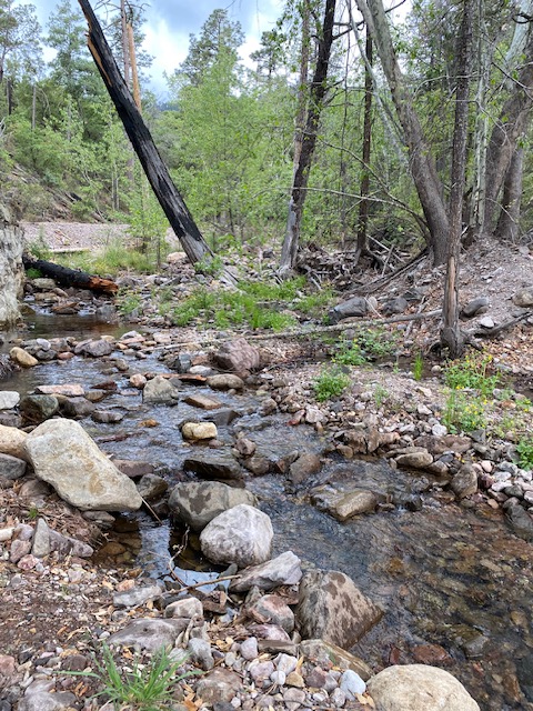
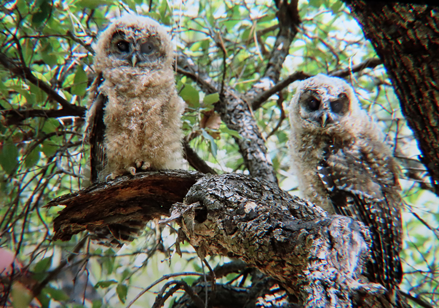
The proposed developments overlie a Mexican Spotted Owl post-fledging area, part of a critical Protected Activity Center (PAC) delineated for this pair. From personal observations we know that the pair using this PAC brings its fledglings to the riparian area immediately adjacent to the proposed developments each July (see attached photo), and it is reasonable to anticipate that the proposed developments will substantially increase human pressures of various sorts on the owls. Even the proposed seasonal road closure could also increase such pressures, as it will increase foot traffic through the PAC, at least seasonally, compared with the present situation.
To address specific aspects of the draft EA:
Educational Facilities. We fully support continued environmental education activities in Cave Creek Canyon––in fact several CRC Board Members have been involved with FoCCC’s education initiatives. However we oppose any unnecessary structures in South Fork. The proposal to construct new environmental education facilities in South Fork (kiosk, parking, staging area, etc.) is neither needed nor beneficial. It is harmful because it entails destruction of habitat for facilities and parking areas, will impose long-term maintenance costs with very uncertain sources of funding, and will serve to concentrate the public, enhance noise pollution, and result in associated vegetation damage in a sensitive area that is a Mexican Spotted Owl PAC. It is not necessary to do this development in South Fork, especially because environmental education functions are already well handled by the Visitor Information Center (VIC). These functions, in particular emphasizing South Fork values, could be expanded at the VIC if desired, or alternatively could be sited at a location such as the presently closed Idlewilde Campground, which could be reopened as a day-use area and already has facilities such as a vault toilet, tables, and ample parking space, so it need not entail any new habitat destruction or construction costs. There is no need for new facilities in South Fork to enhance environmental education values of the ZBA in South Fork, and building new facilities will negatively impact those very values. We fully support taking small groups of supervised school children from local schools into South Fork, as is currently being done, but do not support the construction of new structures within the canyon.
Picnic Facilities. We fully support provision of picnic facilities in Cave Creek Canyon, but not any picnic facilities in South Fork. The proposal for picnic area development in Alternative B suffers from all the same problems mentioned above for educational facilities at the same site, and is likewise unnecessary in South Fork. Much better alternatives exist, including providing some dispersed benches along trails and roads in South Fork that would allow people to rest, observe quietly, and partake of field food, without negatively impacting the Mexican Spotted Owl PAC by adversely concentrating public use in this area. Other already-developed sites such as the Sunny Flat Campground and the presently closed Idlewilde Campground could provide additional areas for picnic activities if needed. A new picnic area in South Fork is not needed and would harm natural values. The proposed development site in South Fork is sufficiently close (.3 miles) to the Sunny Flat developed site that simple modification of Sunny Flat should be considered as one alternative.
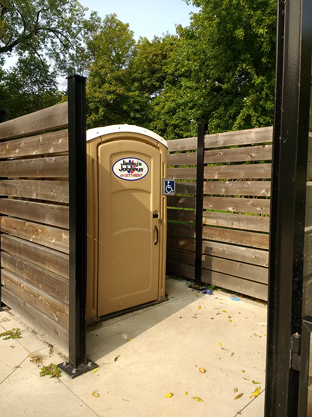
Toilet Facilities. The proposal for improved toilet facilities in South Fork is basically beneficial, but not so at the proposed location, especially because it will degrade a Mexican Spotted Owl PAC and not serve user needs at the most heavily traveled portion of South Fork––the vicinity of the berm. The berm would be a much better location, especially because it is already heavily used as a trailhead. Improving toilet facilities at the berm would also presumably entail much less habitat destruction because parking is already available in the vicinity. The Forest Service has indicated problems in siting a vault toilet in this location because of floodplain restrictions, but it has not provided persuasive arguments and data to support this claim. Hurricane Odile, as massive a storm as we are ever likely to experience, did not flood the nearby cabin area and we find it very difficult to believe that the Forest Service could not find or create a viable vault toilet site in the vicinity, by placing the toilet on a raised pad, as also will be necessary at the proposed location, to raise the toilet out of the floodplain. Moreover, we are aware that the National Park Service has in places developed aesthetically pleasing and functional portable-toilet housing structures for floodplain locations that have successfully provided secure toilet facilities on a permanent basis. These structures, which are handicap-accessible, are basically a slab with just walls that allows easy removal of the portable toilets when the site is threatened by fire or floods (see attached photos). This alternative deserves full consideration by the Forest Service.
Road Closure. The proposal for seasonal road closure in South Fork has had proponents and opponents within the CRC, and here we wish only to consider some advantages and disadvantages of such action. On the plus side, such a closure would have beneficial impacts on road dust, noise, and traffic hazards to people and wildlife along the road during the closure period. But on the minus side are the penalties paid in reduced access to favored locations. Penalties in reduced traditional access were the primary reason why the Forest Service decided not to implement a road closure of South Fork quite a few years back, and this concern remains an issue today. Letters already received by the Forest Service on this issue indicate intense opposition to closure on this basis, and the proposed seasonal timing of the closure will be especially negative for many users. Access issues can be partly addressed by allowing continued access for handicapped users and cabin owners, but this approach will only partly ameliorate the access problem. We fear that closure may arouse so much opposition that the Forest Service will be obliged to immediately reopen the road. Remember also, that road dust, noise, and traffic hazards can be greatly reduced by alternative mechanisms such as water bars, very low speed limits, and strict enforcement of such limits. These mechanisms can operate on a year-round, not just seasonal, basis and may arouse much less opposition.
Trail Loop. The proposed handicapped-accessible trail loop is another feature that could be much better met by other alternatives. We agree that the absence of any handicapped-accessible trail facilities in Cave Creek Canyon should be remedied, but again we think it can be done much more preferably in other locations in the main canyon––locations which would not destroy more habitat or disturb a Spotted Owl PAC in South Fork. As proposed in Alternative B, the new trail in South Fork would of course entail new habitat destruction, both for the new trail itself and for parking. A trail sited here also raises both maintenance concerns––because the trail is largely in the floodplain, entailing significant maintenance costs––and concerns about the danger that flash floods could pose to handicapped users. As one alternative, which would provide excellent wildlife viewing, a hardened handicapped-accessible trail could simply be created alongside the already existing South Fork road (coupled with strict enforcement of a very low speed limit). The wildlife viewing potentials of various parts of South Fork are widely acknowledged to be excellent along the existing road, and a number of sections of the road are especially favorable. This approach need not entail any significant new habitat destruction. Other good alternatives that would not entail new habitat destruction would be to harden the existing trail between Sunny Flat and the Silver Peak trailhead, or to harden the existing trail between Idlewilde and Stewart Campground. All of these alternatives would provide better wildlife experiences than the proposed new trail in South Fork. The CRC can assure the Forest Service that a handicapped-accessible trail, sited properly, would be a feature that our membership would be happy to aid with some assistance in construction and/or finance. In fact, we have already initiated discussion with FoCCC about collaborating on the project.
Need. The draft EA discusses an increase in visitor numbers and indicates an increase in visitation of 58%over the past four years. Without knowing the methodology behind these numbers, it’s difficult to give them much credence. A number of factors could distort this number. In a birding area, the presence of a single bird (recently, Eared Quetzal) can drive a dramatic increase in visitation in a single year, which may not reflect an average over time. Also, the successful opening and improvements of the Visitor Center have led to an increase in recorded visitation. One could easily make the case that because so many people are visiting the Visitor Center, infrastructure should be focused here. Certainly, handicap nature trails and educational activities are most frequently located at Visitor Centers, for a reason.
The attempt to create a Need by citing numbers based on growing populations in areas several hundred miles and many hours away––such as Pinal County––is puzzling. The small area of the Coronado NF found within Pinal County is rural in nature, while the major metro area for Pinal County is Apache Junction, a suburb of Phoenix. This inclusion gives the appearance of “pumping up the numbers” to justify this project. One has nothing to do with the other. It is important to point out that Cochise County, where this project is located, and Hidalgo County are both losing population.
There is no tangible correlation between population increases in urban areas and an increase in visitation to far-flung rural forests. We have reviewed the Coronado National Forest Plan Five-Year Review Report, October 1986 through September 1991. This document looked at impacts and activities in the initial five-year period after the completion of the 1986 Coronado National Forest Plan. Of particular interest was the fact that visitation to the Coronado NF only increased one percent during this five-year period, driven by a large increase of visitation on the Santa Catalina Ranger District.
This increase happened during a decade (1980s) when the population of Cochise County increased by 38.4%, almost double the next closest decade (20.6%) in the fifty years since 1970. Hidalgo County has been losing population for more than 30 years. Population growth is decreasing in both counties containing lands managed by the Douglas Ranger District. Population growth in faraway locations should not be used to justify this project.
Most important, it is not the responsibility of the Forest Service to facilitate any and all visitation to any site, much less to one as special as this. It is the responsibility of the Forest Service to manage visitation pressures, not to promote them.
Climate Change. The CRC was surprised to see that the Forest Service’s only comment on climate change was that we don’t know enough, so we can’t do anything. More surprising, this inadequate statement was pulled from a document written a decade ago. Our understanding of climate change is rapidly improving, and the Forest Service has an obligation to do much better in understanding, explaining, and managing for it. At the least, the Forest Service should be able to find information on the most current thinking on climate change for this region, given that there is no shortage of information available.
Funding. For many years, we have been witnessing decreased government funding for new developments, and we strongly suspect that blocks of funding presently available from some private sources will dry up, once the highly controversial nature of the developments in Alternative B becomes more widely known. Now is no time to invest in new projects that cannot be sustained.
The CRC is concerned that the primary motivation for this construction proposal is the availability of outside money, which should never be the primary justification for degradation of valued public assets. The CRC is also deeply concerned that funding to maintain the new developments in Alternative B will not be forthcoming either from government or private sources. Page 13, bullet point 11 of the EA states:
“The [current Coronado] developed recreation program continues to be unsustainable. Construction costs for the proposed improvements are estimated at over $100,000, and operation and maintenance (O & M) costs would be approximately $10,000 – 15,000 per year. However, two things would reduce this negative effect at South Fork: (1) the Friends of Cave Creek Canyon have agreed to provide funds for construction costs and operations for at least 10 years….”
The Forest Service adds as the second point that user fees would be available, but then concludes that if the estimated ten years’ worth of $10,000 annual maintenance costs are not forthcoming, the site will have to be demolished.
The CRC board would like to recommend a much more thorough consideration of alternatives to the currently proposed actions, which seem certain to be seriously harmful in their impacts. To this end we would like to meet with the District Ranger and Forest Supervisor before this proposal advances. The Forest Service needs to work more closely with organizations and community members beyond the FoCCC, which has a clear financial stake in the developments and lacks a community mandate for its proposals.
Sincerely,
Wynne Brown, President, CRC
Board members:
Josiah Austin
Alan Craig
David Hodges
Michele Lanan
Narca Moore-Craig
Eskild Petersen
Dirk Sigler
Helen Snyder
Noel Snyder
Please also read our Action Alert on South Fork for more information.