CRC comments to CBP on border remediation
The Chiricahua Regional Council has submitted the following comments on CBP’s border remediation plan:
U.S. Customs and Border Protection
U.S. Border Patrol Headquarters
1300 Pennsylvania Avenue – 6.5E Mail Stop 1039
Washington D.C. 20229-1100.
Thank you for this opportunity to comment on the Border Barrier Remediation actions within the U.S. Border Patrol (USBP) Tucson Sector.
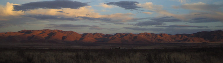
The Chiricahua Regional Council (CRC) is a citizen’s watchdog group that monitors public agency actions and other issues affecting the Chiricahua, Peloncillo and Dragoon Mountains, and nearby areas of southeastern Arizona, southwestern New Mexico, and adjacent northern Mexico. We protect valuable, intact habitats and champion the region’s natural and cultural integrity. Dark skies, open space, outstanding species diversity, corridors that link habitats, our ranching heritage––all of these values make our region what it is. Together, these treasures draw tens of thousands of visitors annually, all contributing to nature tourism, which underpins our regional economy.
General recommendations
CRC recommends the following actions in the Tucson Sector:
• Repair disturbed habitats / prevent the spread of invasive species
These areas need erosion control, revegetation (not just re-seeding) with native plants, and ongoing monitoring for identifying and removing invasive species. Prevent the spread of invasive species in all construction areas by cleaning equipment and establishing an invasive species monitoring and eradication program for target species identified by the Arizona Department of Agriculture Noxious Weed list and USDA Invasive Plants and Weeds of the National Forests and Grasslands in the Southwest Region. This is an economic issue as well as environmental, since local cattle do not favor invasive species such as Lehmann lovegrass, which has already moved into the area near Guadalupe Canyon, brought in by disturbance related to the construction of the existing Border Wall.
• Decommission patrol road extensions
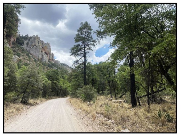
These new border roads pose severe erosion risks, which in turn are dangerous for BP personnel and are highly deleterious to the habitat. The road extensions in Coronado National Forest, Coronado National Monument, and particularly in Guadalupe Canyon and its adjacent BLM Wilderness Study Area, should be decommissioned.
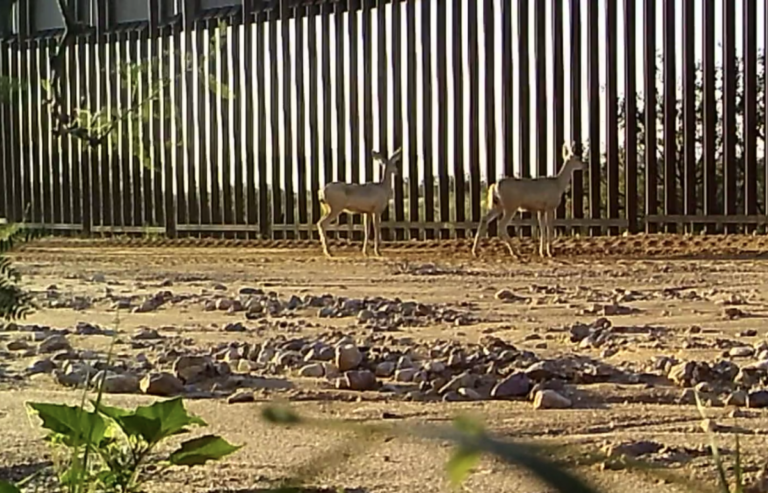
• Create, increase, and expand large wildlife openings
The proposed plan is for wildlife openings the size of a piece of notebook paper (8.5 “ x 11”), which is barely large enough for a cottontail rabbit. Deer, bear, badgers, coyotes, javelina, raccoons, ringtail cats, bobcats, and mountain lions are among the species that cannot pass through an opening this small, not to mention endangered ocelots and jaguars. We strongly encourage CBP to follow the recommended underpass dimensions in the Wildlife Crossing Structure Handbook from the U.S. Department of Transportation and Federal Highways Administration and create wall openings with a minimum dimension of 23 feet wide and 13 feet high and preferred dimension of >32 feet wide and >13 feet high. These large openings should occur every mile along the wall and be monitored for effectiveness using camera traps.
• Keep gates and other barriers across rivers and water crossings open all year
The San Pedro River, Silver Creek, Black Draw, and Hay Hollow are vitally important wildlife corridors during dry seasons when wildlife must be able to move in search of water on the landscape. The gates that are currently open, due to monsoonal flooding, should remain that way, and the ones that are welded shut should be opened.
• Keep any existing gaps in the wall open.
Protect remaining wildlife corridors from further fragmentation by removing physical barriers to restore natural wildlife migration, habitat, and flow of water. The top priority wall gaps to leave open are over the Santa Cruz River, on any protected federal lands (Forest Service, BLM, National Wildlife Refuge, National Monuments and Memorials) and in jaguar Designated Critical Habitat.
• Follow the guidelines and elements included in the National Environmental Protection Act (NEPA), as well as all other cultural and environmental laws, while rejecting use of the waiver.
Solicit, accept, and implement remediation recommendations made by other federal agencies under the Department of Interior including U.S. Fish and Wildlife Service, National Park Service, and Bureau of Land Management and the Department of Agriculture including U.S. Forest Service.
• Do not turn on any of the stadium lighting that has been installed in the San Bernardino Valley or elsewhere.
These lights disrupt the feeding and migration patterns of both birds and bats. They also have a deleterious economic effect on Southern Arizona as many astronomers come to this area for its particularly dark skies.
Specific issues
The plan as it is has a number of deficiencies that make it difficult, if not impossible, for the public to comment on specific areas. For example:
• The points on the CBP Storymaps GIS layer lack GPS coordinates. Assigning an image number and a label of “Rockfall” or “Low Water Crossing” is almost meaningless.
• At least 12 sites along the border wall are simply identified as “Low Water Crossing” with no photography or name – again, this is meaningless without location data.
• Many of the areas that were severely blasted, leading to dangerous erosion, are not indicated on the plan at all, nor are there any photographs of them.
• The gaps in the border wall are not identified, which makes it impossible for members of the public to comment or object.
Therefore, making specific recommendations on the Storymaps GIS map is not useful. As an example:
(1) 31.33377, -109.07102– Guadalupe Canyon
~ We would strongly recommend that the remediation terminate the patrol road that enters Guadalupe Canyon in the Peloncillo Mountains and continues to the New Mexico state line. This is the Peloncillo Unit of critical habitat for the endangered jaguar and vehicle traffic should be kept to a minimum.
Most likely, this point matches up with the CPB datapoint called
(2) 0623BRKO_Other Impacts_photo_2021-6-23—9-49-17_A.jpg
~ But without GPS coordinates it’s difficult to tell that this photo is probably/maybe taken facing south from near the same point as (1).
Our recommendation is therefore the same: We strongly recommend that remediation terminates the patrol road that enters Guadalupe Canyon in the Peloncillo Mountains and continues to the New Mexico state line. This is the Peloncillo Unit of critical habitat for the endangered jaguar. When this area was designated as critical habitat it was done so due to a lack of vehicular traffic in the area. To adhere with the values that led to this designation, both the patrol road should be removed and the Border Wall should terminate at the western boundary of Guadalupe Creek. This will addresses issues with flooding in the area created by Border Wall infrastructure, while leading to a higher level of protection for the endangered jaguar.
Again, thank you for the opportunity to provide feedback.
Sincerely,
Wynne Brown, President, Chiricahua Regional Council
Noel Snyder, Vice President
Eskild Petersen, Treasurer
Michele Lanan, Secretary
Josiah Austin
David Hodges
Chris Roll
Dirk Sigler
Helen Snyder